
When it comes to options for choosing hiking trails in the Yukon, this territory in Northern Canada boasts an embarrassment of riches – and that’s the problem. With so much spectacular wilderness pretty much everywhere you look, the question of where to hike is really only determined by your physical abilities, back-country orienteering skills or what it is that you want to see.
Since Henk and I are ‘occasional’ hikers with limited orienteering experience (and a healthy respect for grizzly bears), we were looking for trails that were easy to moderate in difficulty, 3 hours or so round-trip, and that offered some pretty scenery or unusual features worth photographing. Here are 5 hiking trails in the Yukon that fit the bill and what we discovered on each.
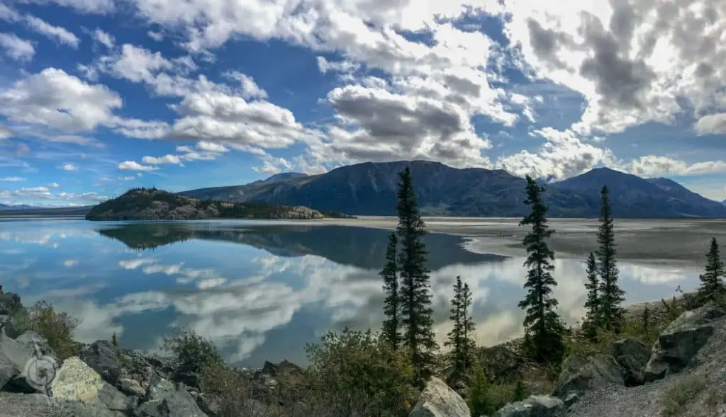
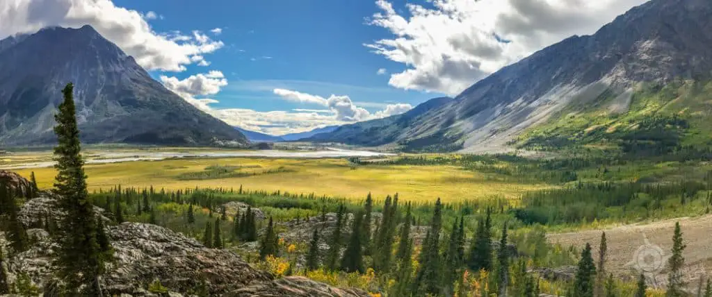
1. Kluane Lake: Hike to an ‘Island With No Name’ Near Sheep Mountain
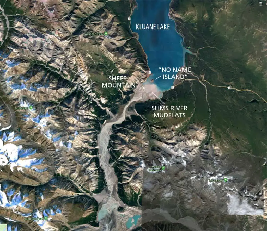
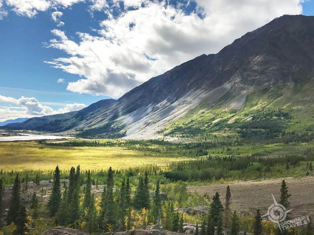
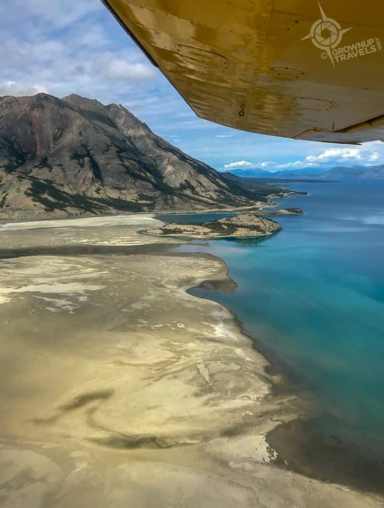
Kluane Lake is the Yukon’s largest lake, offering dozens of trails to hike near its shores. One of the most popular destinations is Sheep Mountain, at the south end of the lake on its western shore where the Slims River empties its waters into the lake – that is, the river used to empty into the lake here, until it abruptly stopped doing that in the spring of 2016.
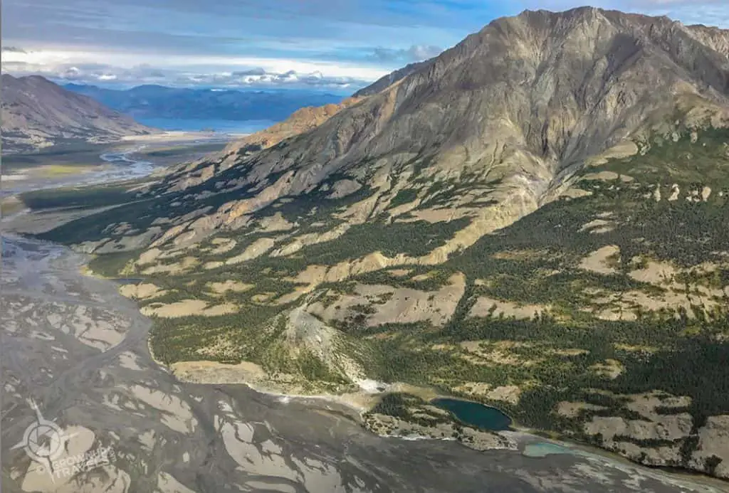
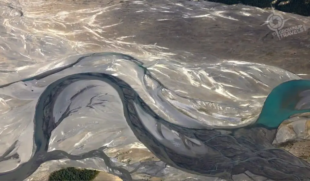
That year, over the course of only 4 days or so, the Slims River ceased to exist, due to the fact that the Kaskawulsh Glacier that fed it had retreated to the ‘point of no return’. This meant that instead of the glacier’s meltwater flowing in 2 directions (one of which was into the Slims Valley and Kluane Lake), the meltwater now only flows eastward through another valley, the Alsek. So, goodbye Slims River.
Wait, How Do You Hike to an Island?
The loss of the river had an unexpected result: what was once an island in Kluane Lake had now become accessible on foot, across the exposed mudflats of glacial silt that had been deposited at the mouth of the river for centuries. Once Henk and I realized we could hike across these mudflats and climb to the top of a former island, we were all in!
NOTE: Despite doing a lot of research online, we couldn’t find an official name for this former island, hence we nicknamed it the ‘Island With No Name”. (we did see one reference to it as Fish Heart Island, but that name was not confirmed on any map.)
The Reward: Epic Shots of Sheep Mountain
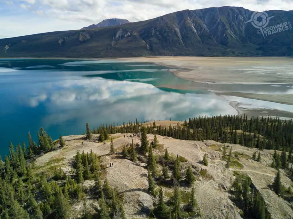
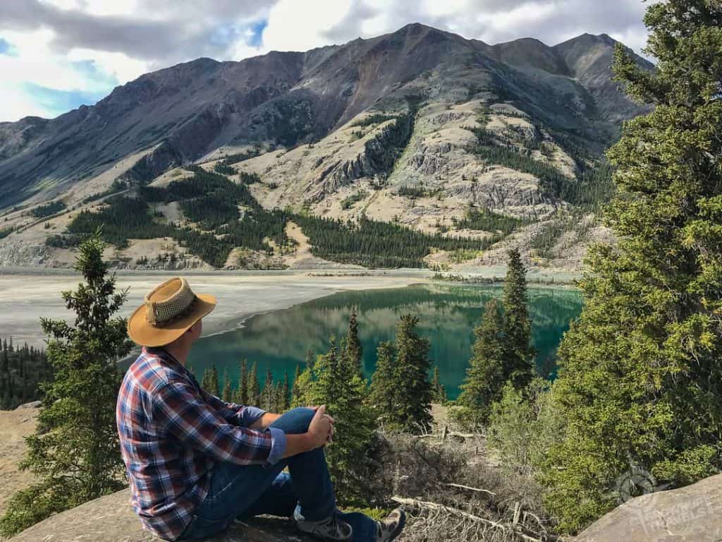
It was interesting hiking across the mudflats and seeing the effects that the wind has already had on this recently exposed ‘land’. The low sand dunes that have formed here are evidence that this part of the Lake is prone to summer dust storms, but the day we visited in late August was absolutely still and a perfect day for the easy climb up to the top of No Name Island.
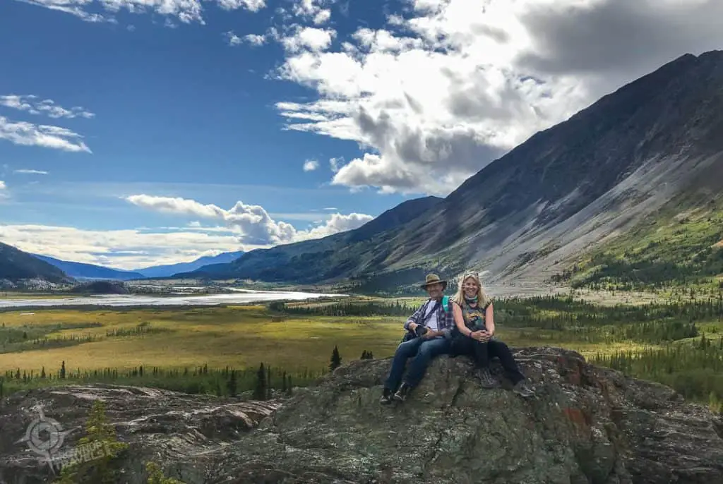
Our reward at the top was an absolutely spectacular image of Sheep Mountain reflected in the turquoise and green waters of Kluane Lake! The dead calm, mirror-like lake and brilliant blue sky made for a photographer’s dream vista.
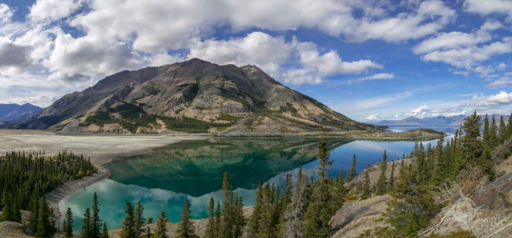
And for a brief time as Henk and I perched on the outcrop at the very top of the island admiring the view, we had that epic panorama all to ourselves. (Talk about feeling like the King and Queen of the Hill!)
TIP: For great reverse views of Kluane Lake and our ‘island with no name’, take another easy and very popular trail up Sheep Mountain itself: the Soldier’s Summit Trail, directly opposite the island. For more Sheep Mountain trail info, check with the Tachäl Dhäl Visitor Centre just off the highway.
2. Kluane Park: Enjoy Panoramic Views at Alsek Valley
The Alsek Valley is located in Kluane National Park and Reserve, a region of sweeping natural grandeur that is arguably the jewel of the Yukon. The entire Park and Reserve includes land in British Columbia and Alaska, making it one of the largest protected wilderness areas on the planet. It also boasts Canada’s highest peak (Mount Logan), one of the largest non-polar ice fields in the world, and carries a designation as a UNESCO World Heritage Site.
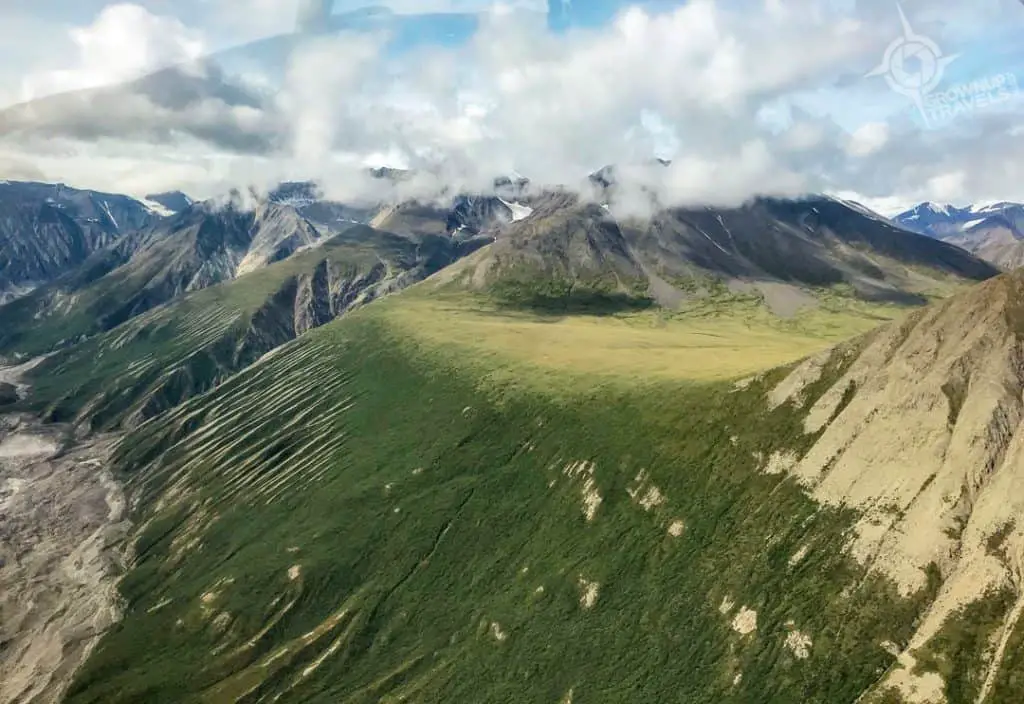
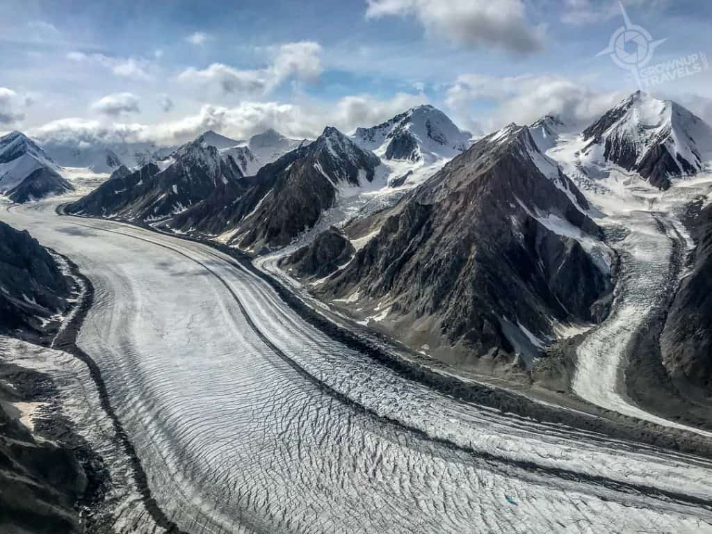
While a flight seeing tour is probably the best way to get a birds’ eye view of just how large and jaw-dropping Kluane Park is, the Alsek Valley is a great place to see one of the Park’s beautiful valleys at ground level.
Fortunately for Henk and I, we happened to be staying very close to the trailhead for the Alsek Valley at the Mount Logan Lodge near Haines Junction. So we didn’t have to go far to start our hike: just to the end of Nygren Subdivision Road. From here, there is an old mining road that leads to the Kluane Park boundary 6 kilometres in.
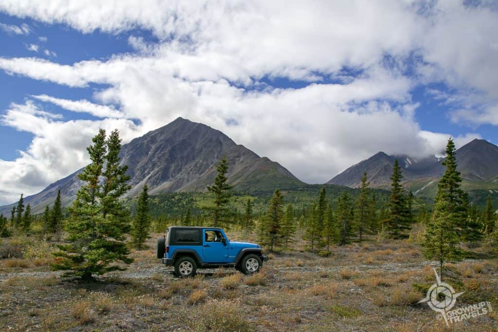
TIP: You can drive on a piece of this old mining road if you have a 4X4 and are careful with your vehicle, as this is a very bumpy ride. Henk and I actually did this with a local guide as we wanted to do 2 hikes on the same day and this saved us some time.
The mining road crosses flat grasslands and goes through stands of stunted spruce and poplar trees, and there are gravel washes and several creeks that criss-cross the route. But once inside the Park boundary, the valley opens up and offers a 180-degree panorama that is breathtaking.
To the right rises Mount Archibald, to the left Mount Martha Black, and in between is a vast river valley for as far as your eye can see. If your eyes are exceptionally good, they might even spot more snow-covered mountain peaks in the distance. Henk and I climbed up the rocky outcrop on the left of the trail and perched for a while to enjoy the view and look for wildlife (no luck).
TIP: The complete Alsek Valley trail is 32 miles round trip (!) but even short hikes require crossing small creeks, even in the summer, so be prepared and come with appropriate footwear (or a change of shoes).
3. Thunderegg Creek
Our second hike of the day was not far from the Alsek trailhead, but in another direction, this time a little to the north to a place called Thunderegg Creek. I’ll be honest here: the hike to Thunderegg Creek is not the most beautiful. Not that it’s ugly, but compared to some of the other hiking trails in the Yukon, this one is underwhelming from a scenic perspective, as it crosses a broad floodplain with stunted trees that isn’t particularly inspiring.
But Henk and I were headed to Thunderegg Creek to see something very specific: geological anomalies called “Thundereggs”.
What are Thundereggs?
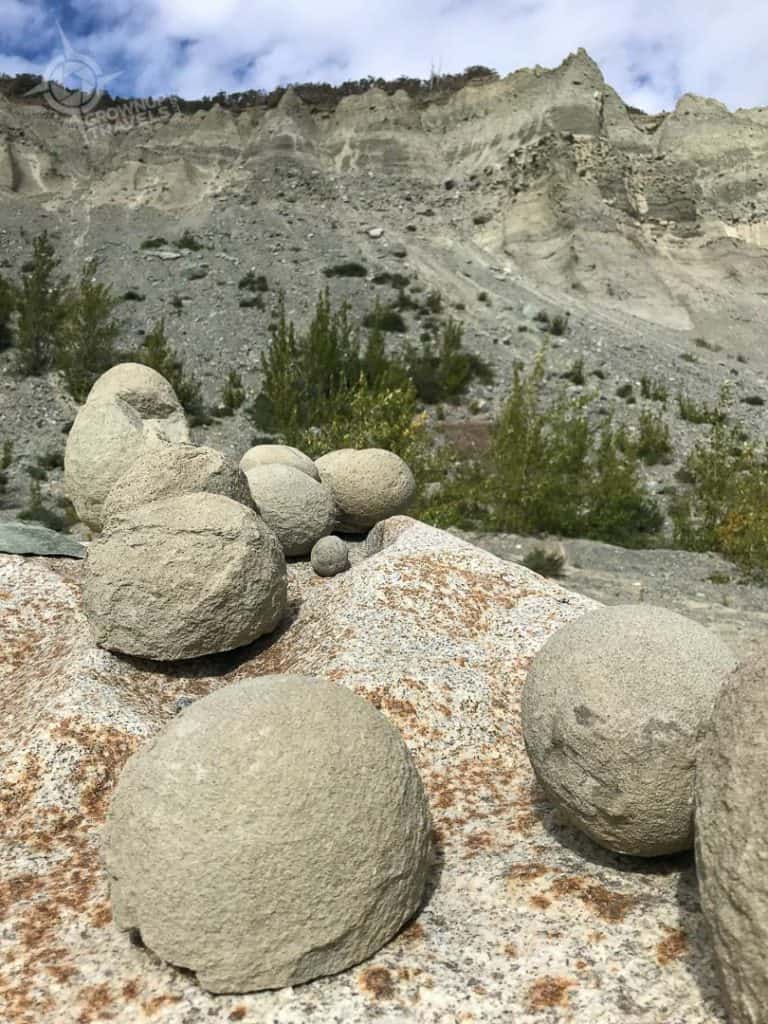
Yukon ‘Thundereggs’ are actually known geologically as concretions, spherical balls that form around a small chip of shale or organic material. They are usually found embedded in a different type of sedimentary rock, and as the host rock erodes, these spherical concretions are exposed.
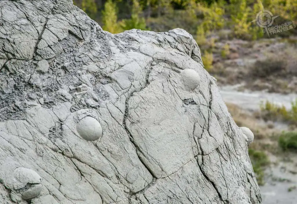
At Thunderegg Ridge, Henk and I found these perfectly round ‘eggs’ everywhere, some the size of bowling balls, half exposed up the sides of the ridge, some broken in pieces at the base of the cutbank where they had rolled down. These spheres had the look and feel of concrete, and it was hard to believe that they weren’t man-made, especially when we found several that were almost the exact same size.
We also found something else when we were walking around Thunderegg Ridge: bear tracks! We weren’t sure whether this was from a black bear or a grizzly, but in any case, it looked pretty big to me and I was glad that our guide had brought along bear spray just in case.
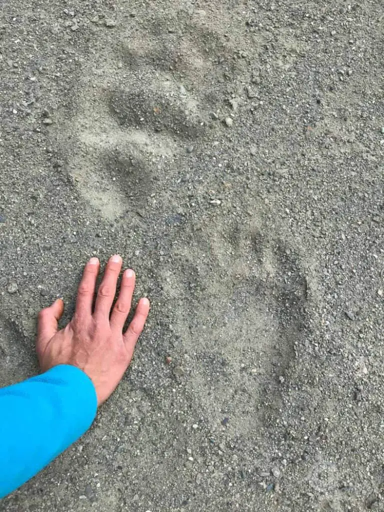
TIP: Kluane Park is known for having the most genetically diverse grizzly bear population and bear sightings are not uncommon. While there’s no need to be ‘bear-anoid’, you should be familiar with what to carry and do if you are hiking in bear country.
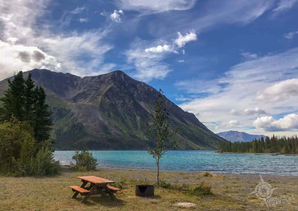
4. Cottonwood Trail at Kathleen Lake
Another great destination for day hiking near Haines Junction is Kathleen Lake, and many of the hikers who come here have one trail in mind: the King’s Throne, a tough vertical trail that leads to an ‘Instagrammable’ perch on an amphitheatre-shaped cirque about 2/3 of the way up to the summit.
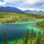
But Henk and I were here more to explore the shores of Kathleen lake than to conquer the mountain beside it. While it may not be as large as Kluane Lake, Kathleen Lake is just as picturesque, with its mountain-rimmed setting and turquoise/blue waters that are known for being exceptionally clear. So Henk and I opted to hike a short piece of the 85-km Cottonwood Trail that would skirt the edge of the mountain and give us great views of the lake from several vantage points.

We were fortunate to be accompanied on our visit by local guide Brent Wenda, who has been leading hikers here for two decades, and who knows the trails and the region intimately. Brent was a wealth of information, pointing out local flora and fauna along our route, including signs of grizzly bears (hairs left in the bark where they rub against trees).
When we stopped at an avalanche path for a snack and to admire the views, Brent kept us entertained with stories of how on really calm days, the water of the lake is so clear that it’s possible to see the shadow of your boat on the bottom of the lake. And conversely, how he has been caught out on the lake in a canoe when the wind has suddenly come up, whipping waterspouts around him as he struggled to return to shore.
Hearing Brent’s stories was yet another reminder that even for a veteran outdoorsman like him, Mother Nature still calls the shots here.
TIP: It’s important to note that a hiking ‘route’ is not a ‘trail’. Routes do not have markers, so if you are inexperienced with navigating in the wilderness, always go for a trail.
5. Miles Canyon, Whitehorse
One last hiking trail in the Yukon that should not be missed, even if you are only flying into Whitehorse for a short time, is the Rim Trail on Miles Canyon.
An ‘Urban Hike’ Close to Whitehorse
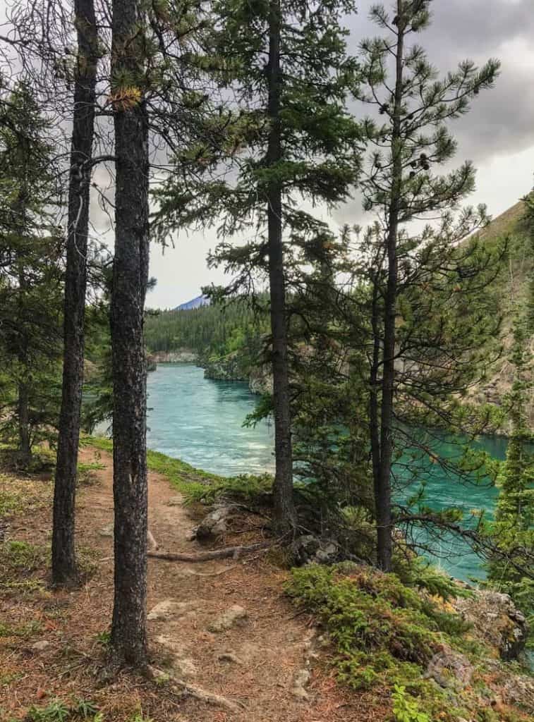
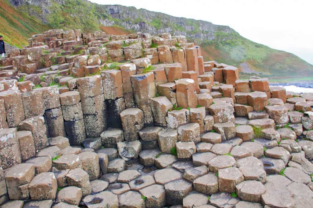
This steep-sided canyon is practically inside the city limits, it’s so close, so there’s no need to drive far if you want to get out and enjoy some of the Yukon’s beautiful scenery. Plus there are two things that make Miles Canyon unique: one is that the canyon walls here are made of basalt, black hexagonal-shaped columns of rock that are formed when lava cools quickly.
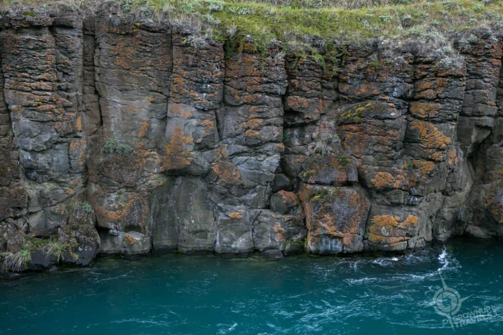
These are the same kind of ancient rock formations you’ll find at the Giant’s Causeway in Ireland, and several other places around the world. Miles Canyon’s basalts actually date back more than 8 million years.
The second thing about Miles Canyon that makes it so special is the incredible turquoise colour of the water that flows between its walls. Because of glacial runoff that deposits light-coloured sediments on the bottom of waterways, many of the rivers and lakes in the Yukon are the colour of jewels and really need to be seen to be believed. Miles Canyon is a great example.
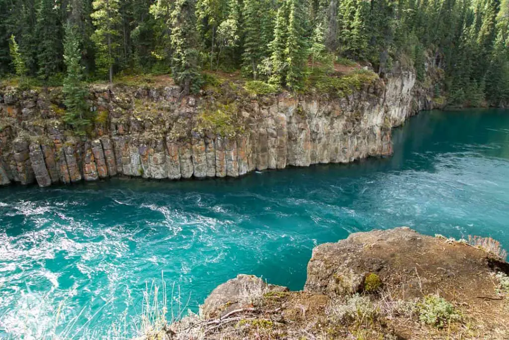
After following the Rim Trail for a kilometre or so you can take a footbridge across the river, giving you the chance to hike the western rim and photograph the river and the basalt walls from that side as well.
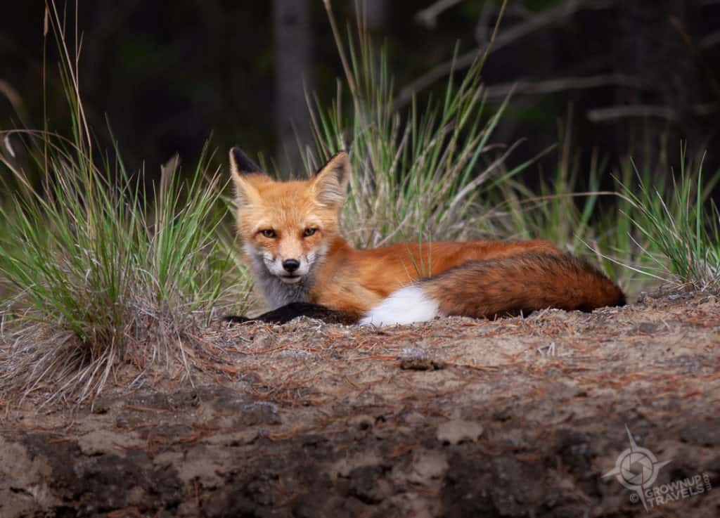
Don’t let Miles Canyon’s proximity to the city fool you – while it may not be located miles away, this canyon is one of the Yukon’s most scenic hiking destinations. And even with Whitehorse so close, this is the Yukon after all, and it’s possible to see wildlife here (we spotted a fox on our short drive to the parking area.)
If you like to hike, even occasionally like Henk and I, the Yukon really is a dream destination. Whether you take it easy or take it to the extreme, there are wilderness hiking trails in the Yukon that always reward you with something beautiful or unusual that you won’t see anywhere else.
Which is my idea of hiking.
For a more comprehensive description of trails and routes in the Yukon Territory, check out yukonhiking.ca.
Special thanks to Travel Yukon who hosted Henk and I on our visit.

Jane Canapini is a member of the Travel Media Association of Canada and the North American Travel Journalists Association. She established GrownupTravels.com in 2014 to share information and tips based on personal experience so her readers could get the most out of their travels.


")
")


Awesome article! I’ve only been to Kluane once, and it was January and way too cold to spend much time outside the car. It looks so gorgeous in summer though! And I’ve never heard of thunder eggs. Very interesting!
We loved what we saw of Kluane and only wished we had allowed more time in the Alsek Valley. That place deserves a day all it’s own to explore.
What wonderful itineraries with such beautiful scenery!
Thanks, Irene. We only touched on the options available for hiking in the Yukon, but at least it was a start!
Wow. I’m pinning this and hoping we can travel to and hike around the Yukon. Especially love the geological formations. The exposed river bed is both sad and intriguing.
I can’t believe you and Tom haven’t been to the Yukon yet! Definitely a spectacular part of Canada and with so few people it feels a little like a step back in time to a simpler way of life. Highly recommend it.
Wow! These 5 easy, but epic hikes look like a perfect way to see some back country in the Yukon. What an amazing way to spend time becoming one with nature. We were really fascinated with the thunder eggs.
I definitely had to see the thunder eggs for myself, too, once I heard about them. But in retrospect, I should have allowed more time for the Alsek trail that day, and less time at Thunderegg Creek, because we would have liked to go deeper into the Alsek valley. Oh well, next time!
You had my attention at “but easy.” I love the great outdoor, but rigorous hiking isn’t something I can do anymore. Thank you so much for your informative post and your glorious photos of the Yukon!!
Thanks so much, Marilyn. And yes, I’m all about the ‘doable’ hikes too, not the knee-crunching, lung-exploding kind! 😉
Makes me want to get my boots on! You had fabulous weather. How did you time it?
We were there for the last 2 weeks of August. Perfect temperatures and no bugs. Definitely a good time of year to hit the Yukon.